 |
|
|
 |
|
|
|
|
|
|
Publications, Links, Videos and Resources to Download.
|
|
Publicações, Links, Vídeos e Recursos para Download.
|
|
|
 |
*** Research Purposes Only
*** Apenas Propósito de Pesquisa
|
 |
|
Click Map preview or click  to download a Hi Resolution Pacific Centered Map (Africa to Africa) or Standart Size Map (GPlates compatible) to download a Hi Resolution Pacific Centered Map (Africa to Africa) or Standart Size Map (GPlates compatible)
|
| Gravity VGG Sandwell Smith |
|
|
| ETOPO 1 Color Ice / Bedrock (Orignal from NOAA) |
|
 |
 |
 |
|
|
|
|
|
|
|
| E1 Grayscale Hillshade + Gravity overlay |
|
 |
 |
 |
|
|
|
|
| E1 Grayscale Hillshade + Bedrock + Gravity overlay |
|
|
| E1 Grayscale Hillshade + Bedrock + Color + FULL Gravity overlay |
|
 |
 |
 |
|
|
|
|
| E1 Grayscale Hillshade + Bedrock + Color + NO Gravity overlay |
|
|
| E1 Grayscale Hillshade + Bedrock + Color + Ocean Gravity overlay |
|
 |
 |
 |
|
|
|
|
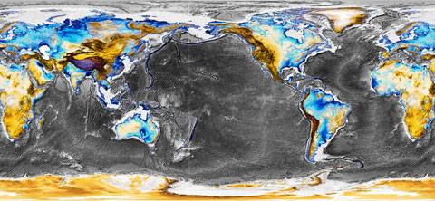
Blue 300 + Ocean Hi 300m inland color blue
Gravity map overlay on deep ocean floor |
|
|
Blue 300 + Ocean Hi 300m inland color blue
Gravity map overlay on deep ocean floor + Drag Marks Pattern. |
|
 |
 |
 |
|
|
|
|
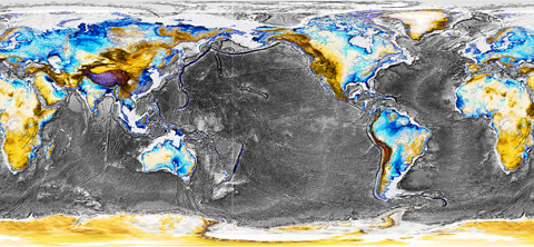
Blue 500 + Ocean Hi 300m inland color blue
Full Gravity map overlay. |
|
|
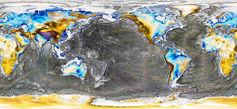
Blue 500 + Ocean Hi 300m inland color blue
Full Gravity map overlay + Transparent Drag Marks Pattern. |
|
 |
 |
 |
|
|
|
|
|
|
|
Drag Marks Pattern ( first draft, work in progress. )
|
|
 |
 |
 |
|
|
|
|
|
|
|
Drag Marks Pattern ( first draft, work in progress. )
|
|
 |
 |
 |
|
|
|
|
| Old Earth Crust ( minus the red is the remains from the Old Earth's crust. ) |
|
|
| New Earth Crust ( minus the red is the newly exposed mantle on the event. ) |
|
 |
 |
 |
|
|
|
|
| Passive Continental Margins on Earth |
|
|
| Active Continental Margins on Earth |
|
 |
 |
 |
|
|
|
|
| Age of the Oceanic Lithosphere (m.y.) |
|
|
|
 |
 |
 |
|
|
|
|
| Global Magnetic Anomalies (WDMAM) |
|
|
| ETOPO 1 Bedrock + Levels adjustments ( light ) |
|
 |
 |
 |
|
|
|
|
| Earth topography - Color Etopo 1 - Ice Surface |
|
|
| Surface of the Earth - Color Etopo 2 (older version) |
|
 |
 |
 |
|
|
|
|
| FreeAirGravity - GPlates - ( levels enhanced ) |
|
|
| E1 Grayscale Hillshade ( levels enhanced, darker ) |
|
 |
 |
 |
|
|
|
|
| Global Seafloor Topography |
|
|
| Global Map of Marine Gravity |
|
|
|
 |
 |
|
|
|
|
| The Rings: Ring of Mountains, Ring of the Deepest, Ring of Volcanoes. |
| Earth's major mountain belts ( Ring of Mountains ) |
|
|
| Earth's deepest places ( Ring of the Deep ) |
|
|
|
 |
 |
|
|
|
|
| Volcanoes of the World ( Ring of Fire ) |
|
|
| Volcanoes of the World, Antarctic highlighted ( Ring of Fire ) |
|
|
|
 |
 |
|
|
|
|
| South Atlantic Magnetic Anomaly, with low intensity magnetic field. ( the entry point of the Pacific Drop ) |
| South Atlantic Anomaly 2020 |
|
|
|
|
|
 |
 |
|
|
|
|
| Pillars of the Mantle or Mantle Plumes, Global Seismic Tomography Model, LLSVP. ( The Pacific Drop Residual Disturbance ) |
| Seismic Tomography of Mantle Structure, Featuring LLSVP |
|
|
| Pillars of the Mantle, Mantle Plumes. ( map 01 ) |
|
|
|
 |
 |
|
|
|
|
| Pillars of the Mantle, Mantle Plumes. ( map 02 ) |
|
|
| Pillars of the Mantle, Mantle Plumes. ( map 03 ) |
|
|
|
 |
 |
|
|
|
|
| Pillars of the Mantle, Mantle Plumes. ( map 04 ) |
|
|
| Pillars of the Mantle, Mantle Plumes. ( map 05 ) |
|
|
|
 |
 |
|
|
|
|
| Map of the event, a draft of the Pacific Drop. ( The Pacific Drop Event Sketch ) |
| South view animation, parcial simulation of the continental drift at the Pacific Drop event. |
Reconstruction:
|
 |
|
Profiles >>
|
 |
|
Parcial view of Earth before the event.
|
 |
|
|
|
|
|
|
External Links: Earth Byte & GPlates / nice places, full of resources.
|
|
 |